When a fellow angler shares a killer fishing spot, they'll often give you coordinates instead of an address. That's because the best spots-submerged wrecks, reef edges, offshore structures-don't exactly have street signs. Knowing how to find location by coordinates is essential for any serious angler who wants to explore new waters and return to productive fishing locations. Whether you're searching for Florida saltwater wrecks or remote freshwater lakes, GPS coordinates are your roadmap to success.
Understanding GPS Coordinates and Why They Matter for Fishing
GPS coordinates use latitude and longitude to pinpoint any location on Earth with incredible precision. Latitude measures north-south position (0° at the equator, up to 90° at the poles), while longitude measures east-west position (0° at the Prime Meridian, up to 180° east or west).
For anglers, coordinates offer several advantages:
- Pinpoint exact locations of structures, reefs, and wrecks
- Share spots with fishing buddies without vague descriptions
- Return to productive locations season after season
- Navigate safely in open water without landmarks
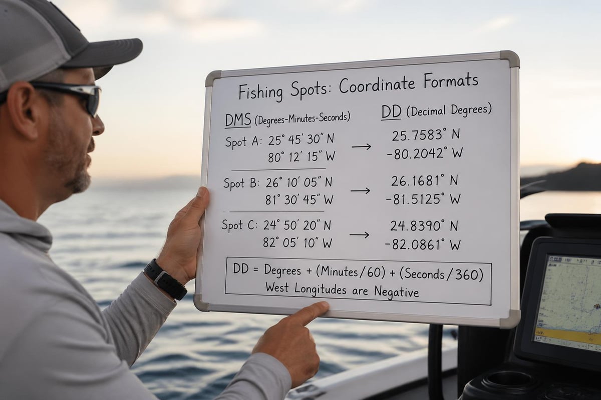
Most modern fish finders and marine GPS units display coordinates in degrees, minutes, and seconds (DMS) or decimal degrees (DD). For example, a productive reef might be at 25°47'15"N, 80°11'30"W (DMS) or 25.7875, -80.1917 (DD). Both formats point to the same location, and learning to use map coordinates helps you work with either system.
Methods to Find Location by Coordinates
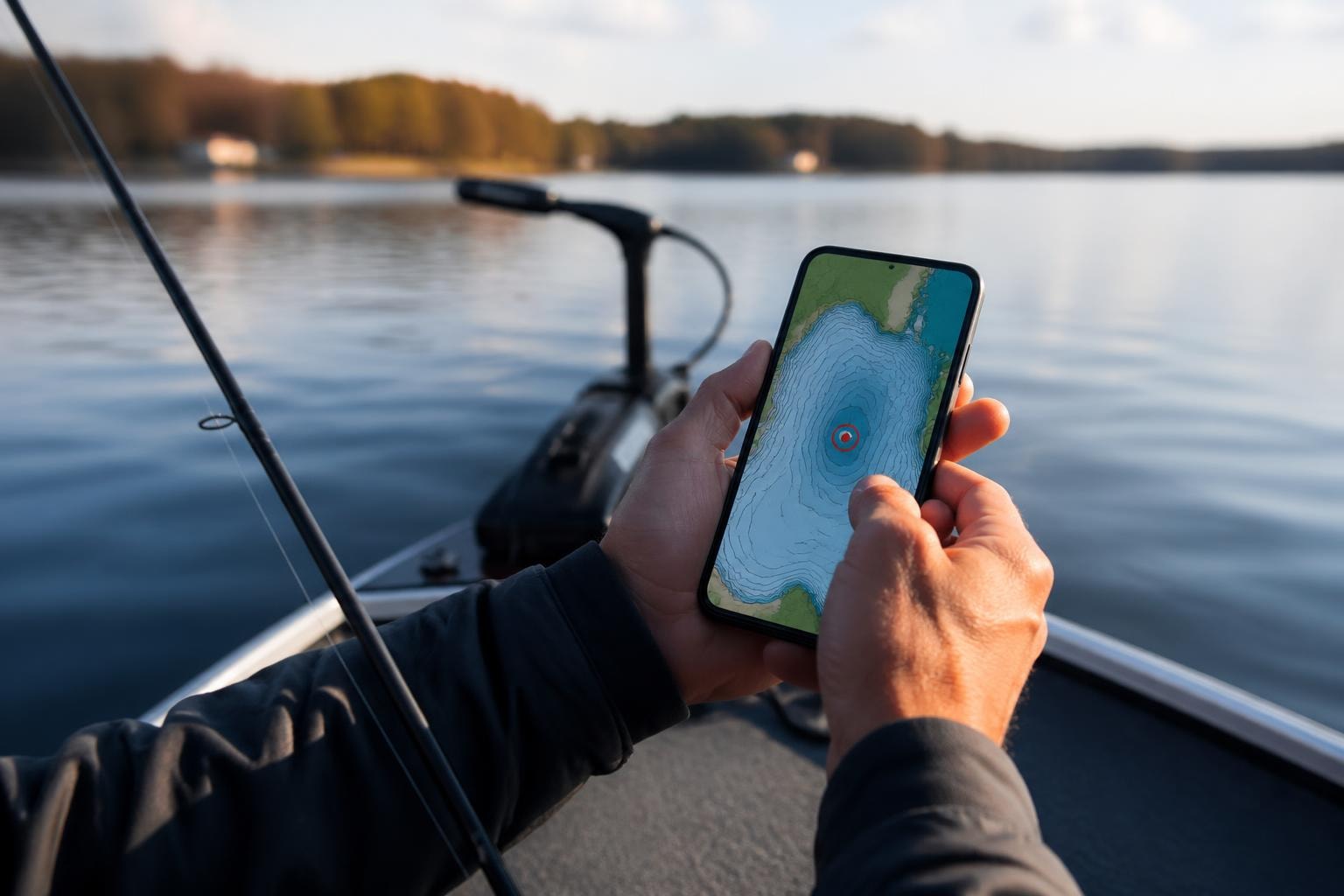
Using Online Mapping Services
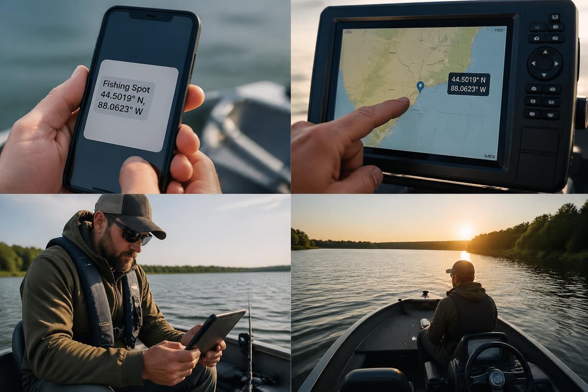
The simplest way to find location by coordinates is through free online mapping tools. Google Maps lets you paste coordinates directly into the search bar-just enter the numbers with a comma between latitude and longitude. The map instantly centers on that exact spot, showing you the surrounding geography and any nearby features.
Microsoft's reverse geocoding services can help you obtain location information from coordinates, which is particularly useful when you want context about what's near a specific fishing spot. This becomes invaluable when checking boat ramps, parking areas, or shore access near your target coordinates.
Popular platforms for coordinate lookup include:
- Google Maps (search bar accepts coordinates)
- Bing Maps (reverse geocoding capabilities)
- OpenStreetMap (open-source mapping)
- Specialized fishing apps with map layers
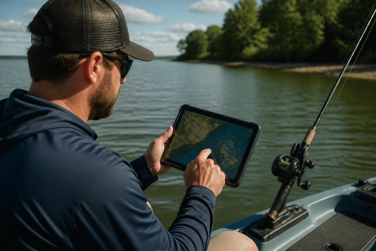
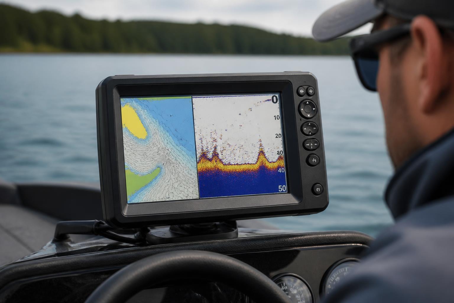
GPS and Fish Finder Navigation
Most modern marine electronics make it dead simple to navigate to saved coordinates. Enter the numbers into your chartplotter or GPS unit, set it as a waypoint, and follow the bearing. Your fish finder displays distance and direction, keeping you on track even in fog or darkness.
Many anglers save productive spots as numbered waypoints-Wreck 1, Reef 2, Structure 3-building a personal database of hotspots over time. When you find location by coordinates that produced fish, mark it immediately. Currents and GPS drift mean returning to within 50 feet of the exact spot can make the difference between limits and skunks.
Professional Mapping Software
For serious navigation and spot research, professional tools like ArcGIS provide advanced coordinate search capabilities. The ArcGIS Location tool supports multiple coordinate formats and makes it easy to plot fishing locations, create custom maps, and analyze patterns across your favorite waters.
ESRI's platform lets you work with specific coordinate systems, which matters when dealing with marine charts that use different datums. NAD83, WGS84, and other systems may show slightly different positions for the same physical location, so consistency matters when marking spots.
Practical Tips for Finding Fishing Spots by Coordinates
Verifying Coordinate Accuracy
Always double-check coordinates before making a long run offshore. A single misplaced digit can put you miles from your target. Cross-reference coordinates against known landmarks-if someone says a wreck is 3 miles offshore but the coordinates show 30 miles out, something's wrong.
When fellow anglers share spots, confirm the coordinate format they're using. Mixing up DMS and DD formats is a common mistake that sends you to the wrong location. You can find location latitude longitude using conversion tools if you need to switch between formats.
Building Your Coordinate Database
Smart anglers maintain organized records of productive coordinates. Create categories for different species, structure types, or seasonal patterns. California coastal spots fish differently than North Carolina inlets, so tagging coordinates with notes about conditions, tides, and catches helps you pattern fish over time.
Organize coordinates by:
- Species targeted (stripers, redfish, grouper)
- Structure type (wrecks, reefs, drop-offs)
- Season or water temperature
- Success rate and catch history
Understanding Geocoding for Shore Fishing
While offshore anglers rely heavily on coordinates, shore fishermen benefit from geocoding-converting addresses or place names into coordinates. Geocoding services help you explore public access points, piers, and shoreline structures. Search for "fishing pier" plus your city, then save those coordinates for quick reference.
Sites like Find Fishing Spots provide coordinates for thousands of locations, from Massachusetts freshwater ponds to New York rivers. Having these coordinates ready means less time searching and more time fishing.
Advanced Coordinate Applications for Anglers
Mapping Multiple Locations
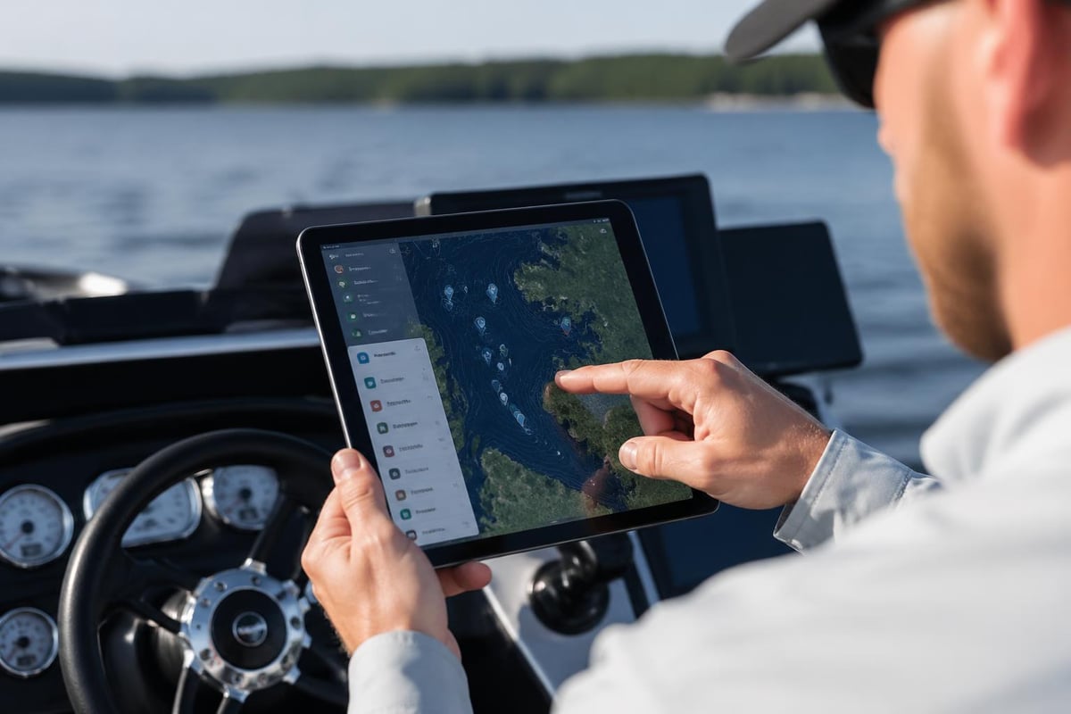
When researching new areas, you might want to plot dozens of potential spots at once. The import function on many mapping platforms lets you plot multiple locations from a spreadsheet or text file. This bird's-eye view reveals patterns-maybe productive reefs form a line parallel to shore, or wrecks cluster near shipping channels.
Creating custom maps with all your coordinates lets you plan efficient fishing trips, hitting multiple spots without wasting fuel backtracking. Export these maps to your phone or GPS unit for on-water reference.
Contributing to Fishing Communities
When you discover productive public waters, consider sharing coordinates with the fishing community. Public resources like artificial reefs, fish havens, and accessible structures benefit everyone when coordinates are documented. Just respect private property and avoid publicizing sensitive spots that can't handle pressure.
Some anglers use coordinate-sharing platforms to build regional fishing knowledge. Adding your catches and conditions to coordinate databases helps others while building your own reputation as a reliable source.
Finding fishing spots by coordinates transforms how you approach your time on the water, giving you precision access to productive locations and the confidence to explore new areas. Whether you're targeting offshore structure or hidden freshwater honey holes, GPS coordinates eliminate guesswork and maximize your fishing time. Ready to discover your next favorite spot? Check out Find Fishing Spots to explore thousands of fishing locations complete with GPS coordinates, access details, and helpful information to get you on the water fast.