
Biscayne Bay: Fishing the Flats, Keys and Reefs from Miami to the National Park
How Biscayne Bay is laid out for anglers, from Miami's bayfront ramps and inlets to the national park's mangrove keys and reef line, plus the rules that make it different.
Related Species
- Bonefish
- Tarpon
- Snook
- Permit
- Gray Snapper
- Mutton Snapper
- Yellowtail Snapper
- Hogfish
- Black Grouper
- Lionfish
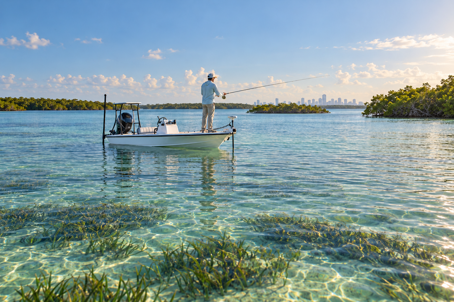
Biscayne Bay runs the length of Miami-Dade County, a long, shallow bay lying between the mainland and the chain of barrier islands and keys that separates it from the Atlantic. Within sight of Miami, its southern half becomes Biscayne National Park, which the National Park Service describes as 95% water and which protects the bay, its mangrove shorelines, the northernmost Florida Keys and a line of coral reefs offshore. Few places let an angler fish a city bayfront, a mangrove key and an offshore reef in the same day.
This guide covers how the bay is laid out, where the public access points in our directory sit, what lives in each zone and the rules that set Biscayne apart from other Florida water. It does not list species-by-species bag and size limits: those change, and many are stricter inside the national park than outside it, so it points you to the official pages instead.
How the bay is laid out
Florida DEP describes Biscayne Bay, Card Sound and Little Card Sound as water bodies formed 3,000 to 5,000 years ago as sea level rose, lying between the mainland and the barrier islands. The bottom is a mix of seagrass beds, hard bottom, sponge and algal beds, with mangrove swamps and salt marsh along the edges. Scientists have documented more than 500 species of fish in the bay, including several sharks such as the bonnethead, nurse and bull shark.
For planning a fishing trip it helps to think of the bay in four zones:
- The northern bay and Miami bayfront — the urban stretch along Miami's shoreline, reached from city and county boat ramps.
- The inlets and channels — the passes that connect the bay to the ocean, where tide moves bait and fish between the two.
- The southern bay and the keys — the national park side: open grass flats, mangrove keys, creeks and banks.
- The reef line — the coral and artificial reefs on the ocean side of the keys, more than ten miles from the mainland by boat according to the park.
Most of the park's water is very shallow, and the National Park Service stresses that knowing the tides is essential: groundings damage both boats and the seagrass and coral below them. Florida DEP adds that seagrass is protected in the Biscayne Bay Aquatic Preserves, and the agency has posted signs at local ramps showing where the grass beds are.
The northern bay and Miami bayfront
The northern bay is the easiest part of Biscayne to reach. Public ramps in our directory along the Miami shoreline include Pelican Harbor Park Boat Ramp, Morningside Park Public Boat Ramp, Watson Island Lot 70 Boat Ramp and Regatta Park - Seminole Boat Ramp. Facilities, fees and hours differ from ramp to ramp, so check each listing before you tow.
This end of the bay borders Florida's most populous county, so expect a city shoreline of seawalls, bridges and marinas rather than wild mangrove, and plenty of boat traffic. The upside is that the inlets are close by when the tide is moving. Florida DEP notes that marine officers here are given materials on local speed zones, seagrass and manatees to use when they stop boaters, so learn the zones before you run.
Inlets, channels and the ocean side
The bay exchanges water with the Atlantic through a handful of passes, and those cuts concentrate current, bait and predators. Government Cut, near South Beach, is a major navigation channel connecting the bay to the Atlantic. To the north, the Bal Harbour Fishing Jetty gives shore anglers a way to fish the inlet that links the northern bay to the sea without a boat.
At the north end of the national park, Biscayne Channel runs past the south tip of Key Biscayne and the stilt houses of Stiltsville. The National Park Service lists Crandon Marina on Key Biscayne as the access point closest to Biscayne Channel and Stiltsville. Just south of Key Biscayne, the shallow Biscayne Flats are another place to look for fish moving with the tide.
Inlets reward caution as much as skill: the current runs hardest here and boat traffic funnels through the same narrow water.
The southern bay and the keys
South of Key Biscayne, the bay opens up into the waters of Biscayne National Park. Here the mainland is a long mangrove shoreline and the eastern horizon is a string of small keys. The park describes paddling across the roughly seven mile expanse of the bay to Elliott or Boca Chita Keys, and many of the lagoons, creeks and channels south of Caesar Creek are too shallow for motorized boats.
Islands and banks in our directory along this stretch include:
- Soldier Key and the Ragged Keys, north of Elliott Key.
- Boca Chita Key and its lighthouse, which the park calls its most popular island destination. Fishing is prohibited inside the Boca Chita Key harbor and within the buoyed area at its mouth.
- Swan Key and Caesar Creek Bank, toward the southern end of the park's keys.
- Long Arsenicker Key, one of the mangrove keys off the mainland east of Homestead.
This is shallow-water, light-tackle country. Bonefish, tarpon, snook and permit all appear on the park's fish list, and the park's own fishing page describes its waters as bonefish habitat. Approach slowly, watch the water depth and avoid running across grass beds.
The park's island harbors have their own rules. Fishing is prohibited inside Elliott Key Harbor and the buoyed area at its mouth, with the exception of the maintenance dock just south of the main harbor. Fishing is also prohibited from the northern side of the Adams Key dock.
Paddling and fishing
For kayak anglers, Biscayne National Park allows visitors to launch their own canoes and kayaks free of charge from a designated area next to the parking lot at the Dante Fascell Visitor Center. The park does not currently rent kayaks. Its paddling page singles out Jones Lagoon and Hurricane Creek, and recommends paddling with a buddy, filing a float plan and checking the weather first. On shore, the park says fishing is permitted from the jetty bridge at Convoy Point, which is wheelchair accessible.
The reef line
On the ocean side of the keys lie the park's coral reefs. Reef and lighthouse structure in our directory includes Fowey Rocks Lighthouse, Triumph Reef and Pacific Reef Lighthouse.
The National Park Service's reef fish monitoring in South Florida focuses on eight species that matter to both recreational and commercial fishing: white grunt, bluestriped grunt, hogfish, mutton snapper, gray snapper, yellowtail snapper, red grouper and black grouper. Biscayne is one of the parks where that monitoring takes place, and it exists partly because reef fish populations have declined. In 2014 the park also released a Fishery Management Plan, developed with the Florida Fish and Wildlife Conservation Commission (FWC), aimed at increasing the abundance and size of targeted species by at least 20%.
Two rules matter on the reef line in particular:
- Legare Anchorage. To protect historic artifacts, anchoring is prohibited in the Legare Anchorage at any time except in an emergency, but hook-and-line drift fishing is allowed. Our Legare Anchorage Northeast listing sits in this area.
- Reef-fishing permits. The park notes that reef fishing from a private vessel requires an additional permit on top of a Florida fishing license.
Mooring buoys help prevent anchor damage to coral, and Florida DEP encourages mooring fields in the bay for the same reason: they give boaters somewhere to tie up instead of dropping an anchor onto reef or grass.
Artificial reefs
Biscayne's natural reefs are supplemented by artificial ones. Miami-Dade County's Artificial Reef Program has been running since 1981 and has placed material at 11 inshore and 17 offshore sites, including almost 50 large vessels, two retired oil production platforms, cast concrete and limestone. The county describes it as the largest program of its kind in Florida by material deployed.
One site has special gear rules. The county explains that the Key Biscayne Artificial Reef Site was designated a federal Special Management Zone in 1990, and fish traps, bottom long lines and spear guns of any type, including slings and pole spears, are prohibited inside it. The Key Biscayne Concrete Art Pods are among the artificial reef listings off Key Biscayne in our directory; check the county's site boundaries before you spear or set gear anywhere near the SMZ.
Rules that make Biscayne different
Fishing in Biscayne National Park follows Florida law, but the park adds several layers. Read the park's current fishing and lobstering page (opens in a new tab) and FWC's Biscayne National Park regulations (opens in a new tab) before every trip. The key points:
- Licenses. A valid Florida fishing license is required to fish in the park, with limited exceptions; children under 16 do not need one.
- Additional permits. Shore-based shark fishing, reef fishing from a private vessel, and specifically targeting snook, spiny lobster or tarpon require additional permits or tags.
- Stricter limits. The park notes that size limits and bag limits for many species are more stringent inside the park than outside it. FWC sets park-specific minimum sizes for several snappers, groupers and grunts, and a 10-fish aggregate bag limit per person that covers many common targets, from snappers and groupers to jacks, porgies, hogfish, great barracuda and snook. Check the current FWC park rules rather than relying on general state limits.
- Protected species. Goliath grouper, Nassau grouper, queen conch, sawfish, sea turtles, corals, sea fans and numerous species of sharks are among the species that cannot be harvested.
- Seasonal bonefish closure. FWC protects a bonefish pre-spawning aggregation inside the park by closing a small marked area to all fishing, and to the possession of fish, from March 1 through May 31. Boats may transit it with fish and gear stowed. Check FWC's map before fishing the southern flats in spring.
- Lobster and traps. Taking lobster is prohibited in the Biscayne Bay/Card Sound Lobster Sanctuary. All traps and all lobster harvest are also prohibited in the park's five Coral Reef Protection Areas, which are marked with yellow buoys; FWC lists Fowey Rocks Lighthouse among them.
- Convoy Point. Fishing is prohibited in the park headquarters boat basin, at the entrance road and beside the boardwalk near the canoe launch, and cast netting is prohibited along the Convoy Point jetty and footbridge.
Across all national parks, fish you release must be returned to the water carefully and immediately, and dumping bait or bait buckets into the water is prohibited.
Lionfish
The park describes the invasive lionfish as the most abundant invasive species in its waters, and it encourages visitors to harvest them safely. Lionfish have venomous spines, so handle them with care. The park notes that a recreational fishing license is not required to take lionfish with a pole spear, a Hawaiian sling, a handheld net or a spearing device designed for lionfish, but a license is required for other methods, including hook and line.
Eating your catch
The National Park Service points anglers to the Florida Department of Health for fish consumption advisories that apply to Biscayne Bay, Florida Bay and the Florida Keys. Check them before keeping fish for the table, particularly larger predatory species.
Planning a trip
For boaters, the park lists four Miami-Dade County marinas that give access to park waters: Homestead Bayfront, just south of park headquarters at Convoy Point; Black Point, with a canoe and kayak launch and a fishing jetty; Matheson Hammock, near the northern part of the park; and Crandon, on Key Biscayne. Marinas may close temporarily when parking fills up, so start early on busy days.
The park has no entrance fee, and because it is almost entirely water, it is open to boats at all times. Because the park has no boat concessioner, there are few boat tours to the islands and reefs, so private boating is the main way to reach them. The park and Everglades National Park also offer boating classes in English and Spanish on local regulations and safe boating.
Biscayne Bay rewards anglers who plan around tide, wind and the rules of each zone: a bayfront ramp and a moving tide for the northern bay, a calm morning and polarized glasses for the southern flats, and a mooring buoy and the right permits for the reef line.
Related Locations
Related Fishing Tournaments
Gasparilla Bowl Inshore Slam Fishing Tournament 2026
Oct 16, 2026 · Tampa, Florida
2027 Florida Keys Lionfish Derby
Apr 22–Apr 25, 2027 · Key Largo, Florida
Gold Cup Tarpon Tournament 2027
Jun 21–Jun 25, 2027 · Islamorada, Florida
About the Author
Find Fishing Spots
The Find Fishing Spots editorial team covers all things fishing, from fishing spots and tournaments to species guides, fishing tips, and helpful resources. Find Fishing Spots helps anglers discover new places to fish and useful information for planning their next day on the water.
Sources & Further Reading
- Fishing and Lobstering — Biscayne National Park (National Park Service) ↗
- Biscayne National Park — Recreational Regulations (Florida Fish and Wildlife Conservation Commission) ↗
- Nearby Marinas — Access for Boaters, Biscayne National Park (National Park Service) ↗
- Canoeing and Kayaking — Biscayne National Park (National Park Service) ↗
- Resources of Biscayne Bay Aquatic Preserves (Florida DEP) ↗
- Artificial Reef Program (Miami-Dade County) ↗