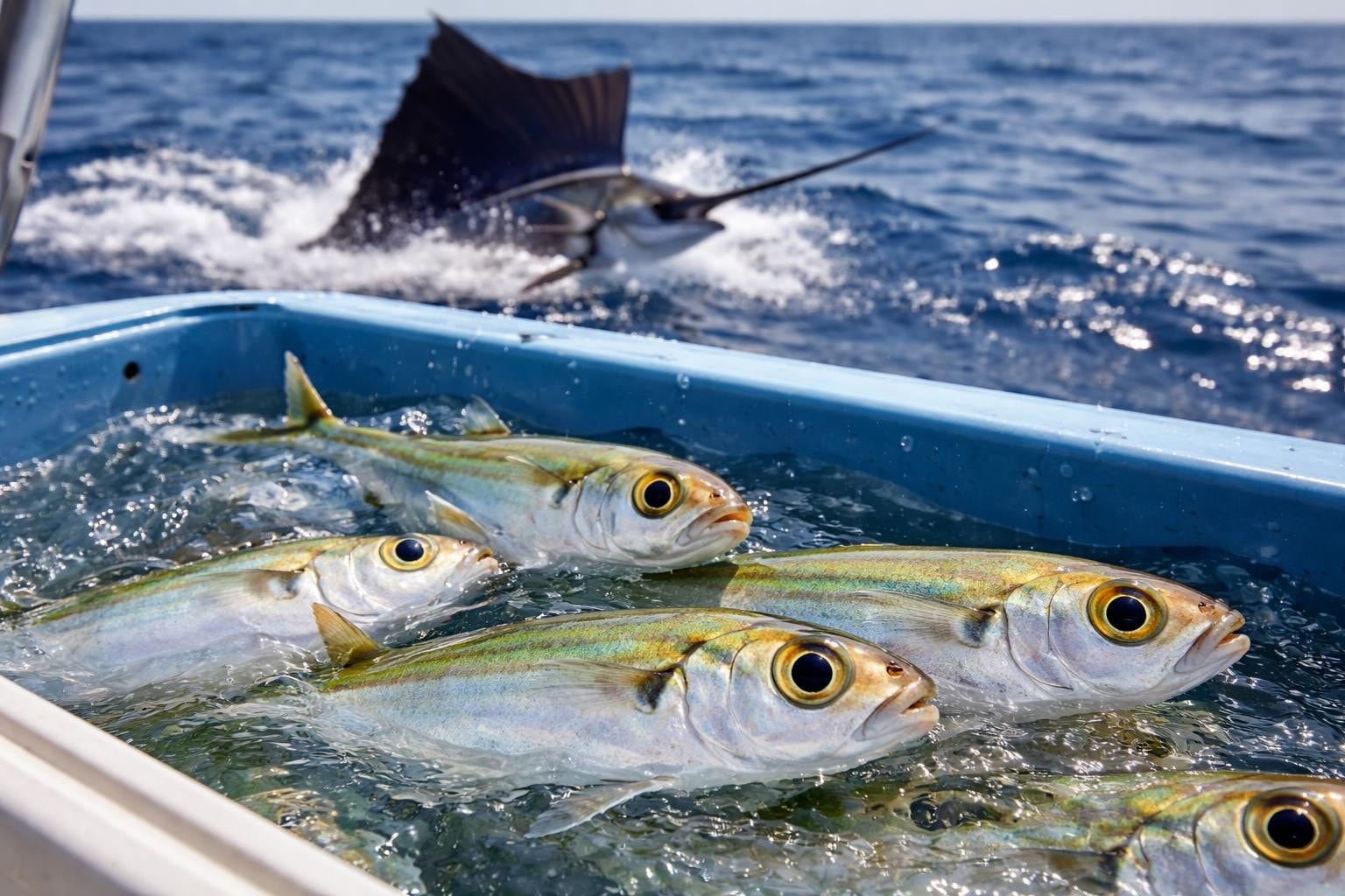
If you've ever wondered how anglers return to that exact honey hole where they crushed it last season, the answer usually comes down to gps coordinates. These strings of numbers might look like mathematical gibberish at first glance, but they're actually the most reliable way to mark and relocate fishing spots on open water or along vast stretches of shoreline. Whether you're chasing bass on a sprawling reservoir or trolling offshore for tuna, understanding how to read, record, and use gps coordinates can transform your fishing game from hit-or-miss to consistently productive.
What GPS Coordinates Actually Mean
GPS coordinates are essentially a precise address for any point on Earth's surface. They consist of two main components: latitude and longitude. Latitude measures how far north or south you are from the equator, while longitude measures how far east or west you are from the Prime Meridian.
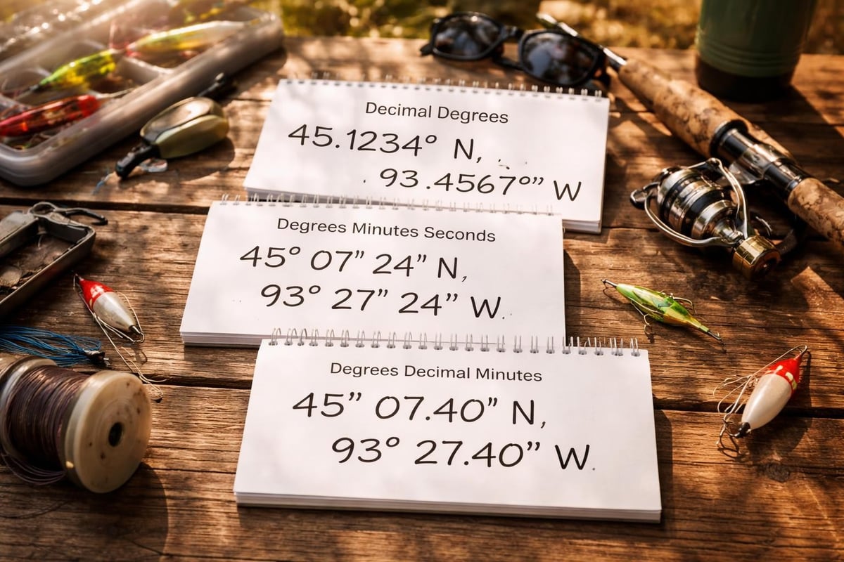
Most coordinates you'll encounter come in one of these formats:
- Decimal degrees (DD): 25.12345, -80.54321
- Degrees, minutes, seconds (DMS): 25°07'24.4"N, 80°32'35.6"W
- Degrees and decimal minutes (DDM): 25°07.407'N, 80°32.593'W
The decimal degrees format is what you'll see most often in fishing apps and modern GPS units because it's simpler to type and share. NOAA’s National Ocean Service provides detailed information about how these positioning systems work and why accuracy matters for navigation.
How GPS Works on the Water
Your GPS unit or smartphone receives signals from multiple satellites orbiting Earth. By calculating the time it takes for signals to reach your device from at least four satellites, the system triangulates your exact position. This happens continuously, updating your location several times per second.
On the water, this technology becomes invaluable. You can mark coordinates for:
- Productive reefs and structure
- Weedlines and drop-offs
- Artificial reefs and wrecks
- Access points and boat ramps
- Areas with recent fish activity
The U.S. Forest Service guidance on setting GPS units to the correct map datum ensures your coordinates match standard mapping systems, which is crucial when sharing spots with fishing buddies or planning trips using online resources.
Using GPS Coordinates for Fishing Success
Recording gps coordinates takes seconds but pays dividends for years. When you find productive water, immediately mark the spot in your GPS or phone. Don't trust your memory, even if the location seems obvious. Water looks different under various conditions, and shoreline features that seem distinctive today might blend together next month.
Building Your Personal Fishing Database
Smart anglers treat their collection of gps coordinates like a treasure map. Keep notes alongside each set of coordinates: what you caught, what worked, tide conditions, time of year, and water temperature. This contextual information transforms simple waypoints into a strategic fishing database.
Many fishing spots listed on directories like Find Fishing Spots include precise coordinates that you can plug directly into your GPS unit. These verified locations give you starting points, especially when exploring unfamiliar waters in Florida’s Key Largo region or other productive areas.

Coordinate Accuracy and Common Issues
Not all gps coordinates are created equal. Your typical smartphone GPS is accurate to within 15-30 feet under ideal conditions, which works fine for most fishing applications. Dedicated GPS units often perform better, especially in challenging conditions like heavy tree cover or canyon walls.
Watch out for these common accuracy problems:
-
Datum mismatches: Different mapping systems use different reference points. WGS84 is the modern standard, but older maps might use NAD27 or NAD83. The geodetic datum system you're using must match your maps.
-
Signal interference: Clouds, storms, and electronic interference can degrade GPS accuracy. Wait for a clear signal before marking critical waypoints.
-
Transcription errors: A single wrong digit can put you miles off target. Always double-check coordinates when entering them manually.
The USGS information on GNSS systems explains how professional-grade accuracy is achieved, though most fishing applications don't require survey-level precision.
Sharing and Finding Coordinates Responsibly
The fishing community has mixed feelings about sharing gps coordinates publicly. Some anglers guard their honey holes fiercely, while others believe sharing knowledge elevates everyone's experience. There's wisdom in both approaches.
When sharing coordinates online or with fishing groups, consider the fragility of the resource. A small pond that fishes well can quickly become overpressured if hundreds of anglers descend on it simultaneously. Use discretion when sharing:
- Publicly accessible spots that can handle traffic
- General areas rather than exact points for sensitive locations
- Information with trusted fishing partners who respect the resource
Online fishing directories serve as excellent middle ground. Platforms like Find Fishing Spots focus on publicly accessible locations where sharing coordinates helps anglers discover legal fishing opportunities without damaging fragile ecosystems or revealing someone's hard-won secret spot.
Converting and Verifying Coordinates
Before heading to a new spot based on coordinates you found online, verify them using mapping software. Pull up the coordinates in Google Maps or a marine chart to ensure they actually point to water and not someone's backyard. This simple step prevents wasted trips and potential trespassing issues.
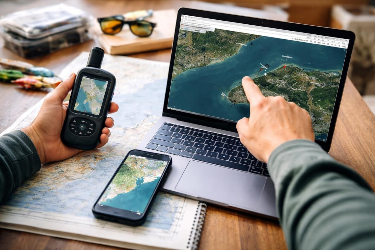
If you're working with coordinates in different formats, you'll need to convert them. Free online converters handle this instantly, or your GPS unit likely has built-in conversion functions. The key is maintaining precision, especially those decimal places that seem insignificant but actually represent dozens of feet.
Advanced GPS Techniques for Serious Anglers
Once you've mastered basic coordinate use, several advanced techniques can elevate your fishing efficiency. Track creation lets you record your trolling paths, helping you replicate successful patterns. Some anglers create digital fences around productive areas, setting alarms when they drift out of the zone.
Modern fish finders integrate GPS functionality, automatically marking waypoints when you hook up. This hands-free approach ensures you never lose a productive spot, even in the chaos of landing a big fish. The technology continues advancing, with some units now incorporating visual geo-localization techniques that could revolutionize how we identify and return to fishing locations.
Weather and tide considerations become more sophisticated when combined with gps coordinates. By correlating your waypoint database with conditions when fish were active, patterns emerge. Maybe that offshore ledge only produces during incoming tides, or perhaps that creek mouth fires up during southeast winds. Your coordinates become the foundation for understanding these patterns.
Understanding and effectively using gps coordinates opens up vast fishing opportunities while helping you consistently return to productive water. Whether you're building your own database of honey holes or exploring new areas using shared coordinates, this technology has become indispensable for modern anglers. Ready to discover your next favorite fishing spot? Check out Find Fishing Spots to explore thousands of verified locations complete with GPS coordinates, access information, and local insights to help you spend more time fishing and less time searching.