Finding productive places to drop a line isn't about luck-it's about knowing how to read clues, use the right tools, and tap into local wisdom. Whether you're chasing bass in farm ponds or redfish along coastal flats, learning to find spots where fish actually hang out will save you hours of casting into empty water. Let's break down the strategies that consistently put anglers on fish.
Understanding What Makes a Spot Productive
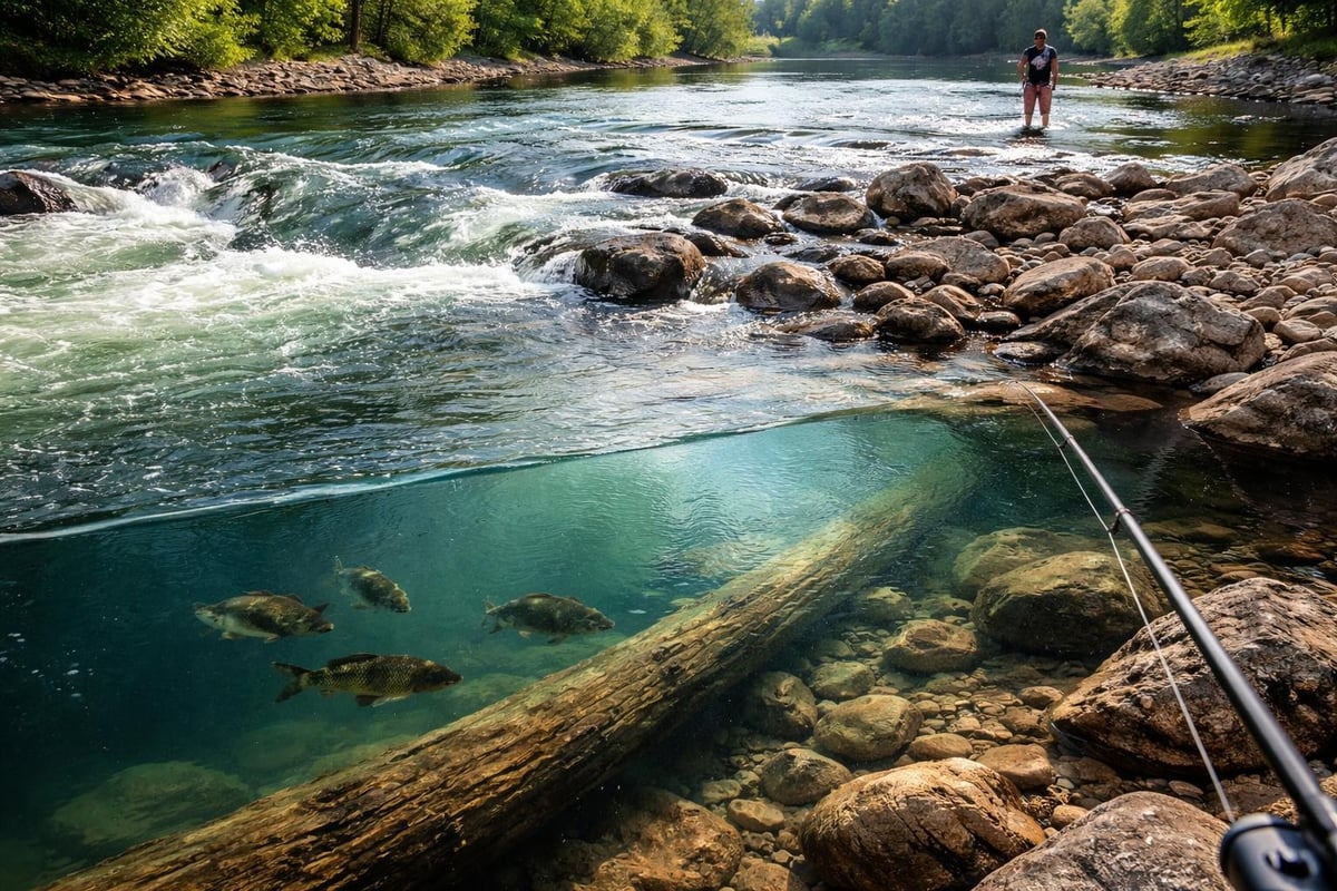
Not all water holds fish equally. Productive spots share common features that attract and hold fish throughout different seasons and conditions. Structure is king-think submerged logs, rocky points, weed edges, and channel drops. These areas provide cover from predators, ambush points for feeding, and relief from current.
Temperature breaks matter more than most weekend anglers realize. Fish position themselves where water temps hit their comfort zone, which changes by species and season. In summer, look for deeper holes or spring-fed areas. During cooler months, shallow flats that warm in afternoon sun become magnets.
Reading Water Features
Learning to identify prime fishing spots starts with understanding what you're looking at. Current breaks, color changes, and surface disturbances all tell stories.
- Current seams where fast water meets slow create feeding lanes
- Color changes often indicate depth transitions or structure
- Surface ripples can reveal underwater points or reefs
- Bird activity points to baitfish schools and feeding predators
Tidal waters add another layer. Rising tides push baitfish onto flats and into marsh creeks. Falling tides concentrate fish in deeper channels and pockets. The hour before and after tide changes often produces the best action.
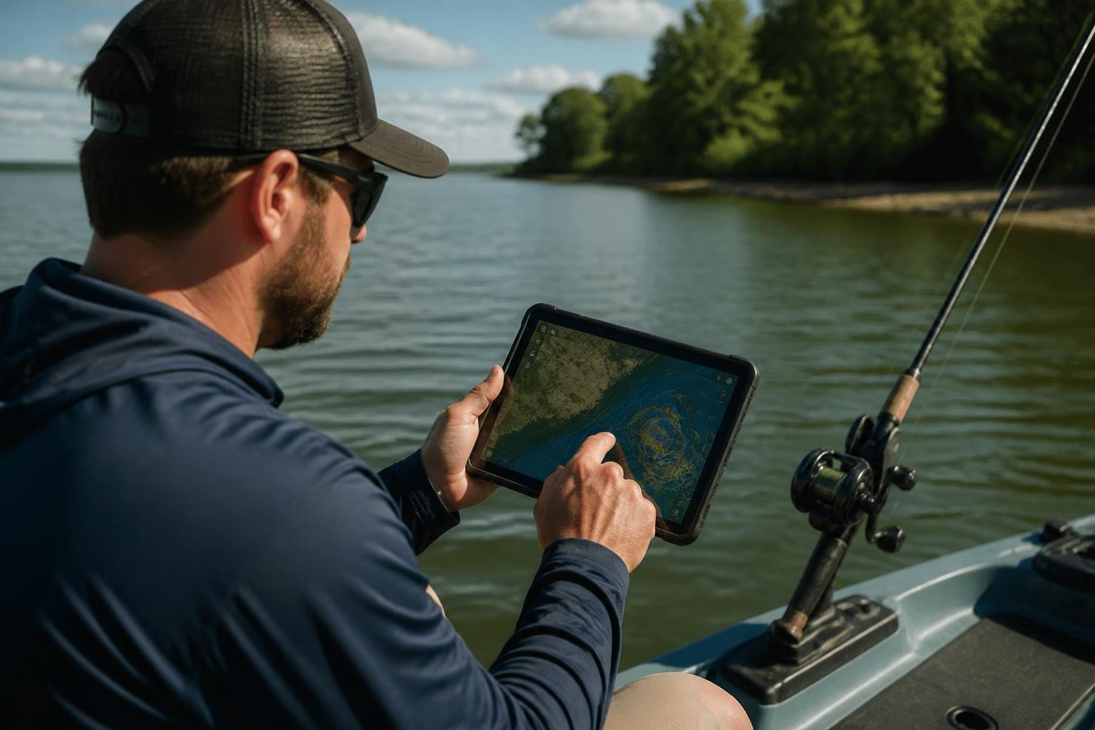
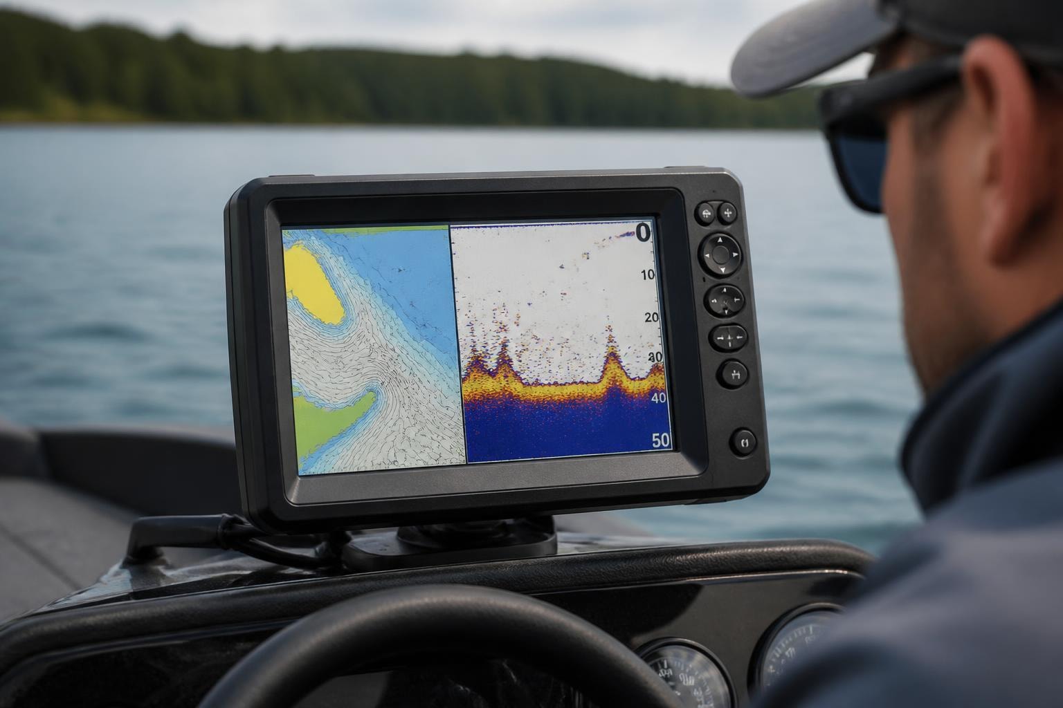
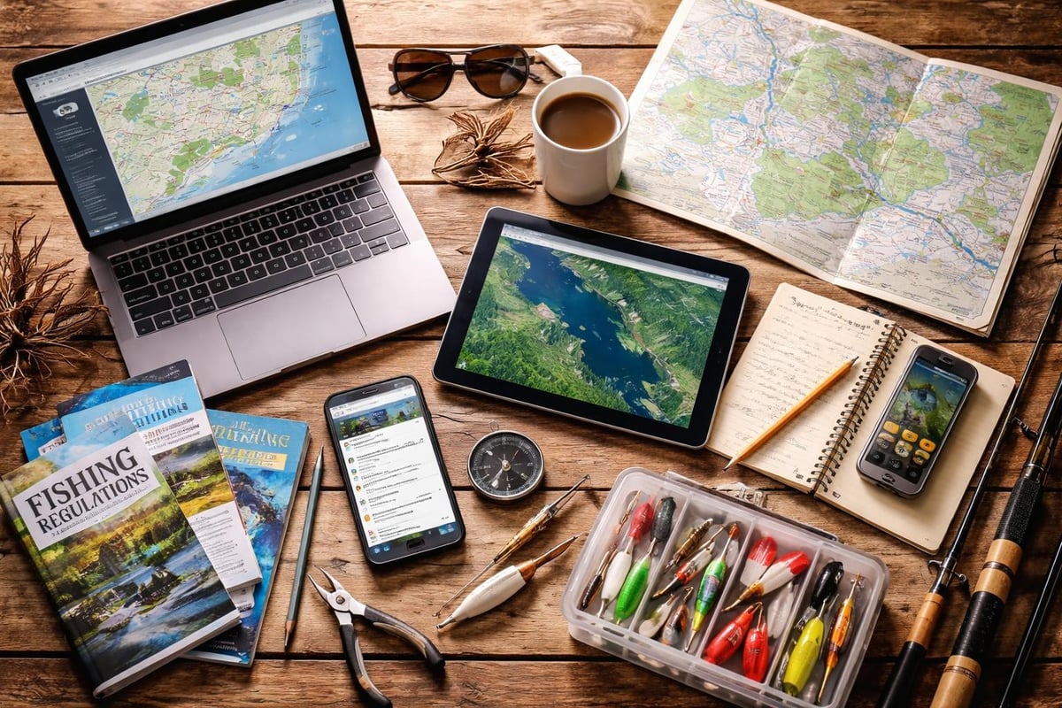
Using Technology to Scout New Areas
Modern tools have changed how we find spots dramatically. GPS mapping apps, satellite imagery, and fishing-specific platforms help you identify promising water before you ever wet a line.
Fishing charts and depth maps reveal bottom contours, drop-offs, and structure that hold fish. Study these maps at home, mark waypoints for interesting features, then verify them on the water. Satellite views on Google Maps show weed beds, channels, and access points you'd miss driving by.
Mobile Apps and Online Resources
Community-driven platforms have created databases of proven locations. Apps like Fishbrain let you see where others are catching fish and what species are active. While you shouldn't fish someone else's exact coordinates without permission, these tools identify productive areas worth exploring.
The key is using multiple sources. Cross-reference app data with state fisheries websites, local fishing reports, and satellite imagery. When several sources point to the same area, you've likely found something worth checking out. For detailed location information across the country, Find Fishing Spots provides GPS coordinates and access details for thousands of locations.
Tapping Into Local Knowledge
No amount of technology replaces talking to people who fish an area regularly. Bait shops, marinas, and tackle counters connect you with folks who know which spots are producing now, not last season.
When asking for advice, be specific but respectful. Don't expect exact GPS coordinates to someone's honey hole. Instead, ask about general areas, what species are biting, and what baits are working. Most anglers will share useful info when approached genuinely.
Join local fishing groups on social media or forums. Read recent catch reports. Pay attention to patterns-when multiple people mention the same general area or technique, that's actionable intel.
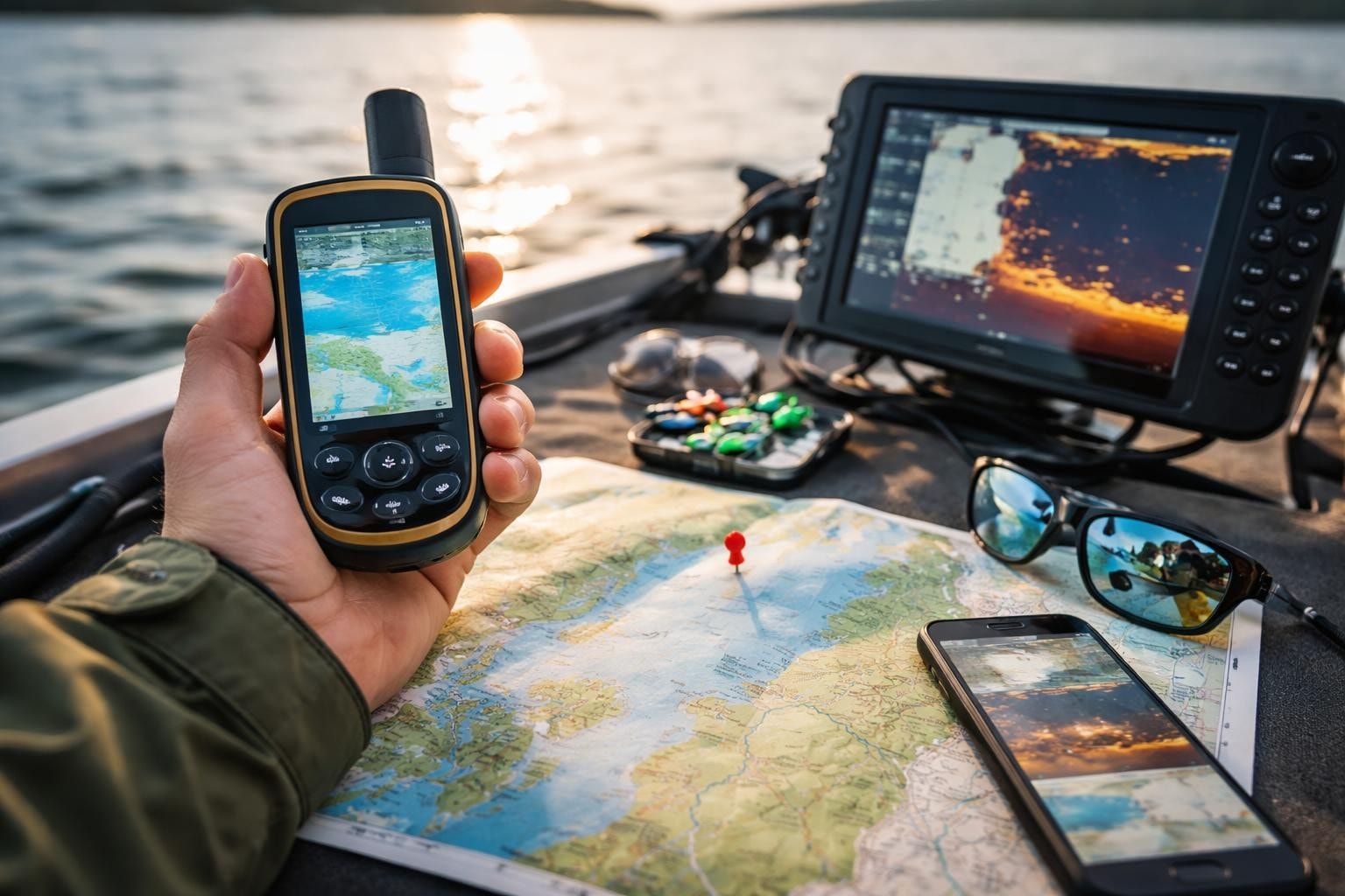
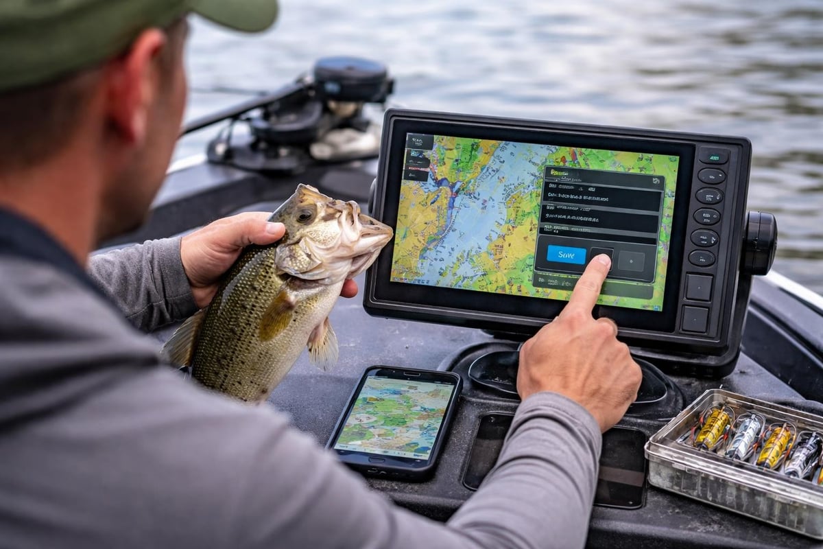
Building Your Own Spot Library
As you find fishing spots that produce, document them properly. Save GPS coordinates, note conditions, and record what worked. Over time, you'll build a personal database more valuable than any public resource.
- Record water level, weather, and tide stage
- Note bait selection and presentation
- Document time of day and moon phase
- Track seasonal patterns year over year
This information helps you find spots that will produce under similar conditions. A place that held fish on a falling tide in May will likely do the same next year.
Exploring Different Water Types
The approach to find spots varies dramatically between water types. Freshwater lakes require different tactics than coastal bays or river systems.
Lakes and reservoirs concentrate fish around points, humps, and creek channels. Study lake maps for depth changes. Focus on 10-15 foot depths during spring and fall, deeper during summer, shallower in late fall.
Rivers and streams position fish predictably. Look for bends, eddies behind rocks, undercut banks, and transitions between pool and riffle. Current always influences where fish hold.
Saltwater flats and bays require reading tides and bottom composition. Grass flats, oyster bars, and mangrove shorelines all hold different species. Areas like Biscayne Bay or Cape Lookout offer diverse habitat worth exploring.
Scouting During the Off-Season
Winter and extreme weather periods are perfect for finding spots you'll fish later. Low water exposes structure normally underwater. You can walk shorelines, identify features, and plan approaches for when fish move in.
Take photos and mark waypoints for stumps, rock piles, and drop-offs. When water rises and fish return, you'll know exactly where to cast. Planning your fishing trips during slower periods means you're ready when conditions turn on.
Verifying and Refining Your Spots
Not every promising location produces fish. The final step is verifying through actual fishing. Give each spot a fair shot-fish it during prime times under good conditions before writing it off.
Try different presentations if your first approach doesn't work. Sometimes fish are present but not actively feeding, or they want a different bait. Spend at least an hour working a new area before moving on.
State fisheries websites often list stocked waters and management areas worth trying. These publicly known spots see pressure but consistently hold fish.
Keep refining your approach based on results. The best anglers constantly adapt, testing new areas while returning to proven producers. Browse fishing spots across regions to expand your rotation and reduce pressure on favorite holes.
Finding productive fishing spots combines research, technology, local knowledge, and time on the water. Start by studying maps and reports, talk to local anglers, then get out and verify what you've learned. Whether you're exploring Florida’s Apollo Beach or North Carolina’s Buxton, the process stays the same. Ready to discover new water? Head over to Find Fishing Spots to explore thousands of locations with GPS coordinates, access information, and details that'll get you on fish faster.